 by
by Flights have been canceled and trains suspended as Storm Jocelyn batters the UK – and forecasters say the worst is yet to come.
The severe weather has severely disrupted travel and the storm is expected to be at its worst early on Wednesday – with the possibility of Met Office warnings being extended through rush hour, the Met Office said.
It comes after eight flights were canceled at Dublin Airport and four at Glasgow Airport on Tuesday evening, train services in Scotland were suspended from 7pm and drivers were warned to postpone journeys.
A search is underway at Porthcawl, south Wales, after it was reported that a person was in the sea just before 6pm on Tuesday.
HM Coastguard said RNLI all-weather lifeboats from Mumbles and Barry Dock with rescue teams from Port Cawl, Port Talbot, Llantwit Major and Llansteffan, along with an HM Coastguard helicopter from St. Tathan, joined the search.
The M48 Severn Bridge and the A66 in County Durham and Cumbria were closed due to high winds with the Humber Bridge, A19 Tees Flyover and the Woodhead Way in Derbyshire and South Yorkshire closed to high sided vehicles.
In Scotland, the A76 was closed in both directions between Skelmorlie and the Seawalls due to water breaking over the sea wall.
The strongest winds of up to 80mph are expected between 3am and 7am on Wednesday, before the storm eases during the day.
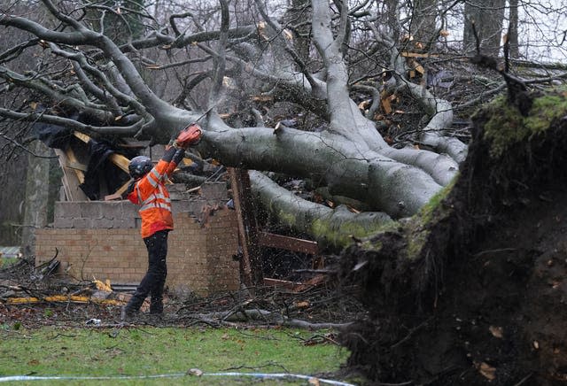
Jocelyn arrived shortly after Storm Isha left two dead and another seriously injured.
Thousands of people are experiencing power cuts, with flooding affecting parts of York.
The Met Office has issued amber and yellow weather warnings for wind covering much of the UK, along with yellow warnings for rain covering parts of western and southern Scotland, and north-west England.
A yellow warning for ice has also been issued across the north and east of Scotland.
Gusts of 80mph could be in exposed areas, with 40-50mm of rain possible over higher ground, the forecaster said.
Meanwhile, winds as high as 76mph have already been recorded in Aberdaron, Wales, on Tuesday evening and Honister Pass in Cumbria saw 77mm of rain – equivalent to around half the area’s January average.
The Met Office’s chief meteorologist, Steve Willington, said Storm Jocelyn, named by Met Éireann, could cause more disruption than Storm Isha.
He said: “Although this system will be a step down from Storm Isha, and the damage and clean-up is still ongoing, we may see more impacts from Storm Jocelyn.
“Wind gusts are expected to reach 55-65mph across north-west Scotland and gusts of 75-80mph may reach a few places, particularly exposed parts of the Western Isles and the north-west coast of Scotland early on Wednesday morning. “

Further transport disruption is expected after services are largely restored on Monday.
Martin Thomson, national operations manager for resilience at Transport Scotland, said: “Across the wider network, we can expect further delays and cancellations to ferries, flights and rail from Tuesday to Wednesday morning.”
Liam Sumpter, route director for Network Rail Scotland, said Storm Isha had caused “enormous damage” and crews were working “around the clock” to remove fallen noses and debris, and repair the damaged infrastructure.
He continued: “While we are continuing to reopen routes when it is safe to do so, unfortunately we are expecting more disruption in the coming days as Storm Jocelyn approaches Scotland.
“If you are planning to travel by train this week, check the status of your journey with your train operator.
“We are also urging neighbors along the line to ensure furniture and garden equipment is secure as in high winds this can blow onto the railway causing damage and disruption.”
Rail services to and from Scotland are expected to be suspended until at least midday on Wednesday.
Road travel is also likely to be affected by the storm.
RAC spokeswoman Alice Simpson said: “With so much heavy rain and debris on the roads, driving conditions will be very challenging, especially across the north of the country where the weather is the least.
“Visibility will be greatly reduced due to the spray from lorries and other large vehicles, and the amount of water on the stop area roads will increase.
Rain clearing east this afternoon, leaving cloudy showers ⛈️
Stay very windy and gales likely for many ⚠️
Feeling light away from the strong winds 🌡️ pic.twitter.com/nua2BcMRYZ
— Met Office (@metoffice) January 23, 2024
“We ask drivers to consider postponing their journeys in these areas if possible.
“We also advise drivers to avoid parking under or near trees.”
Meanwhile, parts of York were affected by flooding.
River and surface water flooding is likely in parts of northern England on Tuesday with river flooding possible on Wednesday, the Environment Agency said.
River flooding is also possible along parts of the upper Severn in Shropshire until Friday.
The number of flood warnings – meaning flooding was expected – reached 15 in England and 17 in Scotland.
The Met Office said the highest wind speed recorded during Storm Isha was 99mph at Brizlee Wood in Northumberland, with gusts of 90mph at Capel Curig in Snowdonia on Sunday.
A 26-year-old man was in a critical condition on Monday night after his car crashed into a tree on a road in Northumberland, police said.
An 84-year-old man has died after the car he was a front-seat passenger in crashed into a fallen tree in Grangemouth, Falmouth, Police Scotland said.
And a man in his 60s was killed in an accident involving two vans and a fallen tree in Lém an Maddy, Co. Derry, on Sunday night, the Police Service of Northern Ireland said.