 by
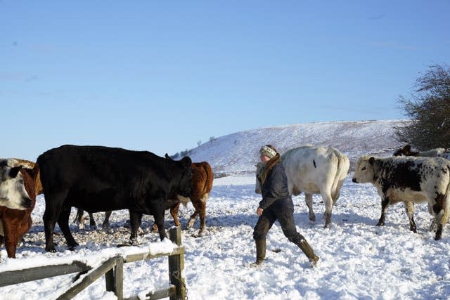
by Temperatures could drop to minus 12C overnight, as forecasters warned that 10-15cm of snow is possible in some areas on Saturday.
The Met Office said the Aberdeenshire, Moray and Highland regions of Scotland were likely to see the lowest temperatures on Saturday night, with minus 12C possible in some valleys in these regions.
He issued an amber warning for snow in Cumbria across Saturday, saying 10-15cm of snow is possible in some areas before showers start to ease overnight.
The Met Office said frequent snow showers will further affect transport and infrastructure in north-west England.
He added that there is “a good chance that some rural communities could be cut off” and that power cuts are likely to be affected, and other services, such as mobile phone coverage, may be affected.
Met Office chief meteorologist Jason Kelly said: “Snow could be heavy at times across Cumbria with thunderstorms… 10-15cm of snow is possible before showers start to ease overnight.
“A low pressure system will bring less cold but more unsettled weather to the south of the UK from tonight, although northern areas (will) continue to be cold with wintry showers and heavy frosts overnight.
“Many areas in England and Wales can expect periods of rain there at the start of next week, which could be heavy at times and there is a risk of flooding. Further snow could be seen on higher hills across parts of North Wales and Northern England.”
The Met Office has also issued a yellow weather warning for snow and ice from 6pm on Saturday to 12pm on Sunday covering much of the Midlands, Yorkshire, north east and north west England, and North and Mid Wales.
The weather service said that although snow will not accumulate everywhere, some places are likely to see 1-3cm, with 5-10cm possible over some hills and mountains in Wales, the Peak District and the South Pennines.
The forecaster said icy patches are likely on untreated roads, footpaths and cycle paths, leading to “some injuries from slips and falls on icy surfaces”.
He warned that some roads and railways are likely to be affected, with longer journey times by road, bus and train.
In Wales, the A470 was temporarily closed between Llechwedd, Blaenau Ffestiniog, towards the Crimea Pass due to the weather on Saturday evening as North Wales Police told motorists to avoid the area.
The Met Office has extended a weather warning for snow and ice in Cumbria, north Lancashire and the Scottish coast south of Dumfries.
The yellow weather warning is in place throughout Saturday but covers a reduced area.
The Met Office has also issued a yellow ice warning from midnight to 8am on Sunday for London, the East of England, the West Midlands and parts of South Wales.
The weather service warned that areas of rain or sleet falling on frozen surfaces could lead to icy conditions and that some injuries could result from slips and falls.
He added: “Rain or sleet is expected to spread from west to east across the area overnight, falling on frozen surfaces and leading to icy patches, possibly even where treatment has been applied. “
Glasgow Airport temporarily suspended all flights on Saturday morning, with transport hub X, formerly known as Twitter, posting at 7.24am that it was doing so due to “heavier snow than forecast”. .
At 10.20am, the airport said: “Our runway is now fully operational again and we are working with our airline partners and their handlers to resume flight schedules.”
It’s not just us who feel the cold, our pets can also struggle during the winter months.
In this article, @BritishVets share their tips for keeping your pets safe and well in the colder weather. #WeatherReady
— Met Office (@metoffice) December 2, 2023
The mercury fell to minus 11C in Aviemore in the Highlands overnight and the Met Office also recorded minus 10C in Ravensworth, North Yorkshire, on Saturday morning.
It is predicted that the temperature will continue to drop over the weekend, with many sporting events cancelled.
Met Office meteorologist Annie Shuttleworth said it will be minus 3C or minus 4C for many towns and cities on Saturday.
The forecaster said as winds shift to the southwest, temperatures should rise slowly through Saturday, feeling a little less cold in the Southwest.
“In other places, although they are still feeling very cold, it is not much above freezing,” she said.
The forecaster said the areas with the most snow on Friday were Aviemore in Inverness-shire with 5cm, Albemarle in Northumberland and Bingley in West Yorkshire with 2cm, and Loftus, Cleveland, with 1cm.
There were disruptions to trains in the west of Scotland, with operator ScotRail posting: “The snow is affecting some signaling systems and staff are working as quickly as possible to get these fixed now. “
Crewe’s FA Cup second round match with Bristol Rovers on Saturday was canceled and rescheduled for December 12, with the playing surface deemed unsafe.
A number of Scottish league games were also postponed, including Dundee United’s trip to Morton and Ayr v Aberdeen at Somerset Park.
Saturday’s high-profile racing game in Newcastle, due to return to Constitution Hill, was called off due to snow on the track.
The UK’s Health Security Agency and the Met Office have issued amber cold health alerts in five regions – East Midlands, West Midlands, North West, North East and Yorkshire and the Humber – until December 5, meaning “there is likely to be an impact of cold weather. felt across the whole health service for a long period of time”.